

Phone Us Today!
(012) 546 0243
Address:
521 Gerrit Maritz
Pretoria North
0182
R9,399.90
Out of stock
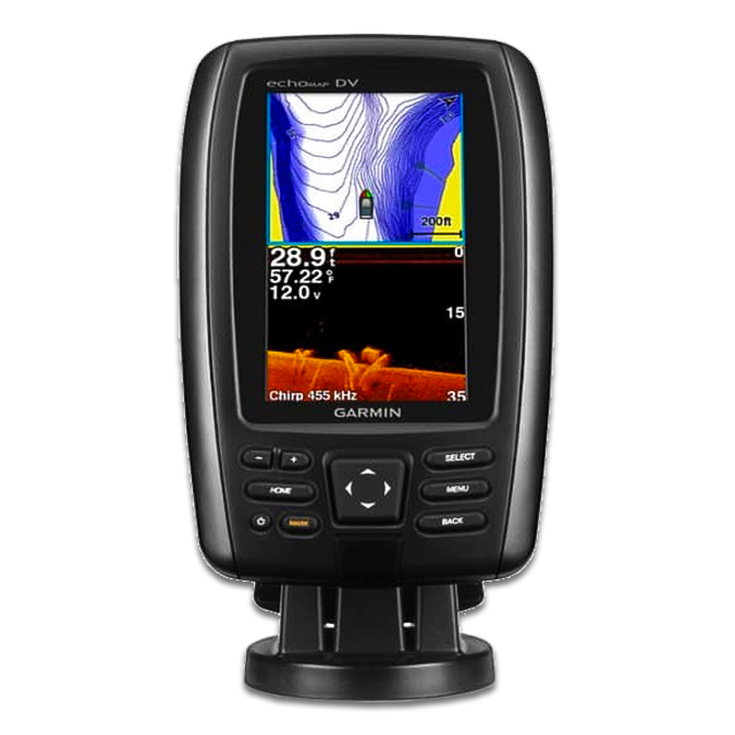
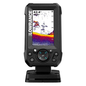
The Garmin Echomap 42dv Fish Finder delivers advanced sonar technology and user-friendly features in a compact package. Designed for serious anglers, it combines dual-frequency sonar, ClearVü imaging, and extensive waypoint management to enhance your fishing experience.
The Echomap 42dv features a 4.3″ WQVGA display with a resolution of 480 x 272 pixels, housed in a compact and durable unit. It supports dual-beam (77/200 kHz) sonar and has a maximum depth capability of 2,300 ft in freshwater. The unit includes options for internal or external antennas and offers both bail and flush mounting options. It also provides connections for NMEA 0183 input and output. The Garmin Echomap 42dv Fish Finder combines advanced sonar technology with a user-friendly interface. With features like dual-frequency sonar, ClearVü imaging, and extensive waypoint management, it enhances your fishing trips by providing clear and detailed underwater images. Its compact design and robust features make it a reliable choice for both freshwater and saltwater fishing. Upgrade your fishing gear with our advanced Fish Finders.
| Weight | 2 kg |
|---|
The Garmin Echomap 42dv Fish Finder features a 4.3″ display, dual-frequency sonar (50/200 kHz), and ClearVü imaging for detailed underwater views. It supports up to 5,000 waypoints, 100 routes, and 50,000 track log points. The unit includes internal or external antenna options and offers a maximum depth of 2,300 ft in freshwater. Ideal for precise fish tracking and navigation, it combines advanced sonar capabilities with a compact design.
Boating